

| App Name | Zoom Earth |
| Developer | Neave Interactive |
| Category | Weather |
| Size | 28.5 MB |
| Latest Version | 3.1 |
| Available on |


Stay informed and safe with real-time tracking of hurricanes, typhoons, and tropical cyclones using Zoom Earth. This dynamic weather map service offers a comprehensive suite of tools designed to keep you updated on severe weather events as they unfold. From detailed satellite imagery to advanced hurricane tracking, Zoom Earth ensures you have the latest data at your fingertips.
Key Features of Zoom Earth
1. Satellite Imagery: Zoom Earth provides high-resolution, near real-time satellite images sourced from leading meteorological agencies like NOAA GOES, JMA Himawari, EUMETSAT Meteosat, and NASA's Aqua and Terra satellites. This feature allows you to visually track the progression of tropical storms and cyclones around the globe.
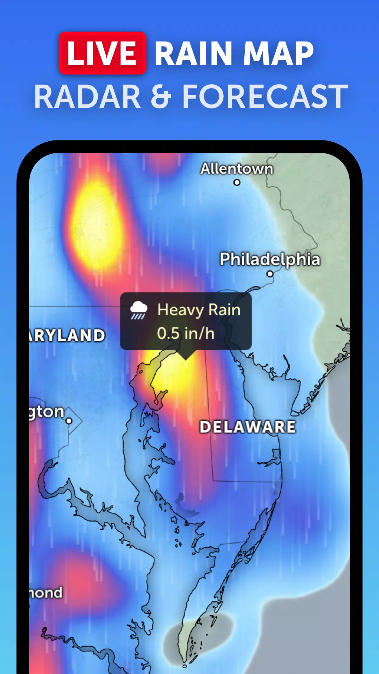
2. Rain Radar: With Zoom Earth's real-time rain radar, you can monitor rain and snow patterns as detected by ground-based doppler radar. This helps you stay one step ahead of the weather, preparing for incoming storms effectively.
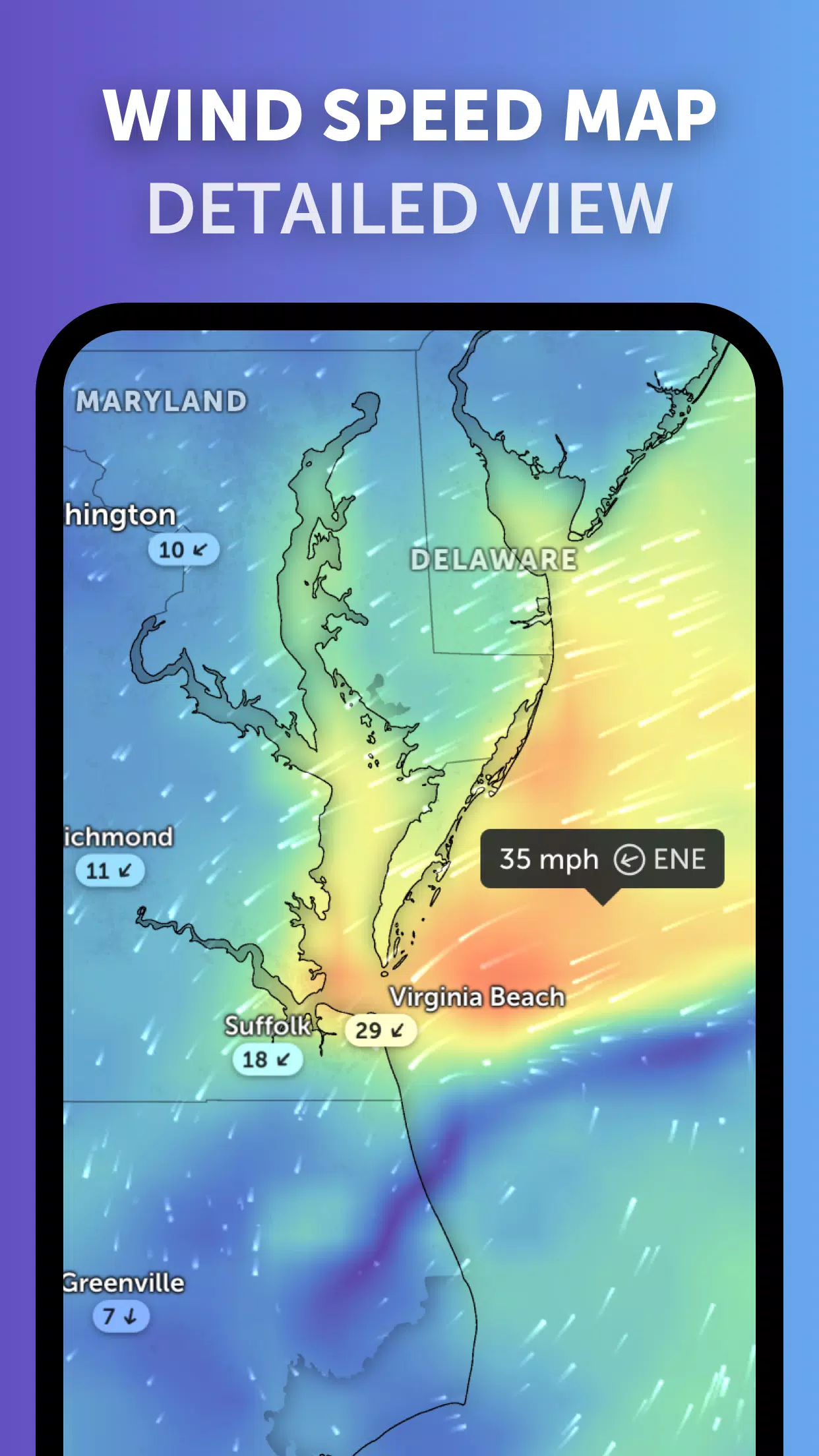
3. Weather Forecast Maps: Dive into interactive weather visualizations with Zoom Earth's global forecast maps. These maps display a range of data including precipitation, wind speed and gusts, temperature, "feels like" temperature, relative humidity, dew point, and atmospheric pressure, providing a comprehensive overview of upcoming weather conditions.
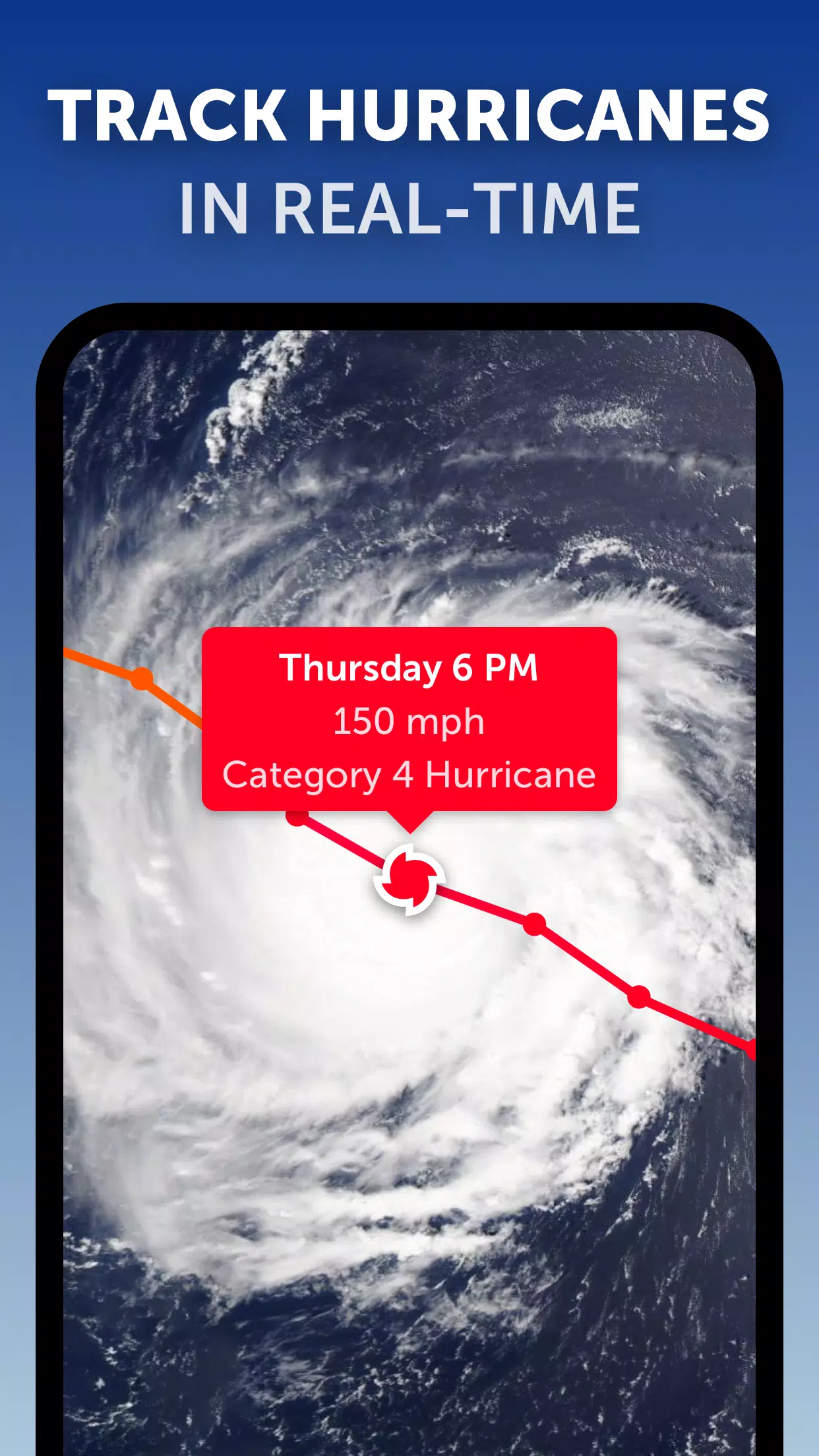
4. Hurricane Tracking: Zoom Earth excels in tracking hurricanes from their early stages through to becoming powerful category 5 storms. Utilizing the latest data from the National Hurricane Center (NHC), Joint Typhoon Warning Center (JTWC), Naval Research Laboratory (NRL), and the International Best Track Archive for Climate Stewardship (IBTrACS), this tool offers unparalleled insights into tropical cyclone activity.
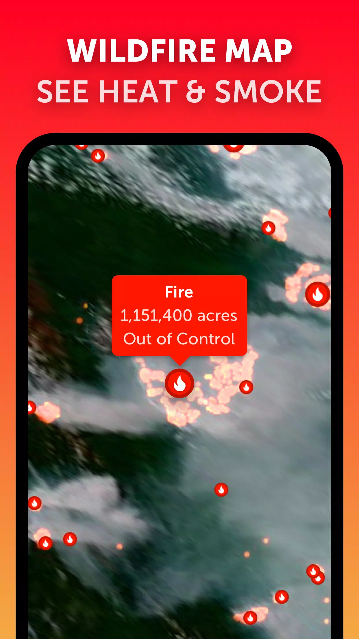
5. Wildfire Tracking: Stay informed about wildfires with Zoom Earth's active fires and heat spots overlay. Updated daily with data from NASA's Fire Information for Resource Management System (FIRMS), this feature highlights areas of high temperature that indicate potential fire activity.
6. Customization: Tailor your weather tracking experience with Zoom Earth's customization options. Adjust settings for temperature units, wind units, time zones, and animation styles to suit your preferences, ensuring a personalized and user-friendly experience.
Latest Updates in Version 3.1
Released on September 19, 2024, Zoom Earth's latest update brings several enhancements:
- Reduced clutter when viewing multiple tropical systems, making it easier to focus on individual storms.
- Separate alerts for Atlantic and Eastern Pacific systems, allowing for more targeted notifications.
- Improvements to map labels, enhancing readability and user experience.
With Zoom Earth, you can confidently track hurricanes, typhoons, and tropical cyclones in real-time, ensuring you are always prepared for severe weather events. Whether you're a weather enthusiast or need to stay informed for safety, Zoom Earth is your go-to tool for comprehensive and real-time weather tracking.
-
 Azure Latch Codes (March 2025)
-
 Roblox: SpongeBob Tower Defense Codes (January 2025)
-
 Honkai: Star Rail Leak Reveals Tribbie\'s Signature Light Cone
-
 Persona 5: Phantom X Playtest Leaks on SteamDB
-
 Nintendo Games Galore: 'Bakeru' and 'Peglin' Reviews with Sales Highlight
-
 Honkai Impact 3rd & Star Rail Crossover Arrives in Version 7.9!